Navajo County on the map of Arizona 2025. Cities, roads, borders and directions in Navajo County of Arizona.
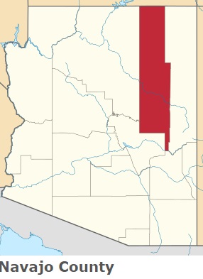
USA / Arizona / Navajo CountyNavajo County is located in the eastern section of Arizona. This exceptional county was named after The Navajo (Diné) people. Navajo is an exonym from Tewa Navahu phrase for big field. The area of Navajo County is about 9,959 square miles. This county, created in 1895, is populated today by 108 thousand residents. Holbrook is the county seat of Navajo County. This map shows the borders of Navajo County as well as neighboring counties, including major highways and natural objecsts as of 2025. Zoom in or out of the map using the plus/minus panel. Move the center of this map by dragging it. Also check out the satellite map of Navajo County.
The borders of Navajo County over the map of Arizona
Explore some more counties of Arizona:
- Yuma County
- Yavapai County
- Santa Cruz County
- Pinal County
- Mohave County
- La Paz County
- Greenlee County
- Graham County
- Gila County
- Coconino County
- Cochise County
- Apache County
- Pima County
- Maricopa County
Full list of Arizona maps
This online map of Navajo County, Arizona is provided by Bing Maps. Please add a bookmark and share the page with your friends!
© 2025 City maps and famous places