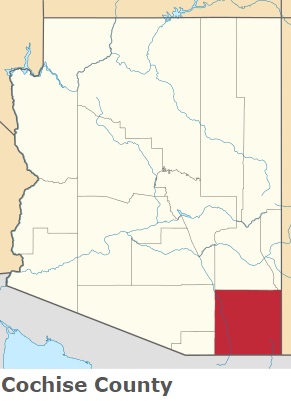
Cochise County is located in the southeastern corner of Arizona. This beautiful county was named after Cochise, a Chiricahua Apache chief and leader of an 1861 uprising. The population of Cochise County exceeds 126 thousand people. The county, formed in 1881, covers an area of 6,219 square miles. The county seat of Cochise County is Bisbee. This map shows the borders of Cochise County as well as neighboring counties,
including major highways and natural objecsts as of 2024.
Zoom in or out of the map using the plus/minus panel. Move the center of this map by dragging it.
Also check out the satellite map of Cochise County.
Please share the map of Cochise County with your friends:
The borders of Cochise County over the map of Arizona
Explore some more counties of Arizona:
This online map of Cochise County, Arizona is provided by Bing Maps.
Please add a bookmark and share the page with your friends!