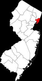
The borders of Hudson County over the map of New Jersey
Explore some more counties of New Jersey:
- Warren County
- Union County
- Sussex County
- Somerset County
- Salem County
- Passaic County
- Ocean County
- Morris County
- Monmouth County
- Mercer County
- Hunterdon County
- Gloucester County
- Cumberland County
- Cape May County
- Camden County
- Burlington County
- Atlantic County
- Essex County
- Middlesex County
- Bergen County
Full list of New Jersey maps
This online map of Hudson County, New Jersey is provided by Bing Maps. Please add a bookmark and share the page with your friends!