Please share the link with friends and neighbors:
Share on Facebook
Share on WhatsApp
Share on Telegram
Share on Facebook
Share on WhatsApp
Share on Telegram
Algeria is listed in:
Cool facts and FAQ about Algeria:
What makes Algeria so unique?Is it safe to travel to Algeria?
Do I need a visa to visit Algeria?
What language is spoken in Algeria?
What currency is used in Algeria?
When is the best time to visit Algeria?
Some cool facts about Algeria
Are there any cultural customs to be aware of in Algeria?
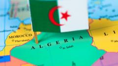
Image of Algeria:
Check out some more famous and interesting places on our planet:
- Sri Lanka
- Macao
- Ukraine
- Guinea-Bissau
- New Caledonia
- Guinea
- Ghana
- Georgia
- Gabon
- Ethiopia
- Djibouti
- Côte d'Ivoire
- Cuba
- Colombia
- Aruba
- Chad
- Cameroon
- Botswana
- Bosnia and Herzegovina
- Benin
This online map of Algeria is provided by OpenStreetMap.
Please add a bookmark and share the page with your friends!