Please share the link with friends and neighbors:
Share on Facebook
Share on WhatsApp
Share on Telegram
Share on Facebook
Share on WhatsApp
Share on Telegram
Cheaha State Park is listed in:
Cool facts and FAQ about Cheaha State Park:
What is Cheaha State Park and why should I visit?How do you get to Cheaha State Park?
What outdoor activities are available at Cheaha State Park?
Can you hike and backpack in Cheaha State Park?
What camping and lodging options are at Cheaha State Park?
Is there a fee to enter Cheaha State Park and what facilities are included?
What should I know before visiting Cheaha State Park?
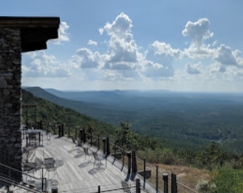
Image of Cheaha State Park:
Check out some more famous and interesting places on our planet:
- Hormuz Strait
- Yonaguni Monument
- South China Sea
- Joshua Tree National Park
- Point Nemo
- Walden Pond
- Niagara Falls State Park
- The strait of Malacca
- Hurricane Ian
- Amalfi Coast
- Doheny State Beach
- The border between Europe and Asia
- Cape Canaveral
- Komodo island
- Iguazu Falls
- Jeju Island
- Ha Long Bay
- Cumbre Vieja
- Oak Mountain State Park
- Gulf State Park
This online map of Cheaha State Park is provided by OpenStreetMap.
Please add a bookmark and share the page with your friends!