Please share the link with friends and neighbors:
Share on Facebook
Share on WhatsApp
Share on Telegram
Share on Facebook
Share on WhatsApp
Share on Telegram
Hungary is listed in:
Cool facts and FAQ about Hungary:
Do I need a visa to visit Hungary?What currency is used in Hungary?
Is Hungary safe for tourists?
What language is spoken in Hungary?
What's the best time to visit Hungary?
How can I get around Hungary?
What should I know about Hungarian cuisine?
Cool facts about Hungary
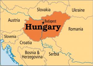
Image of Hungary:
Check out some more famous and interesting places on our planet:
- Sri Lanka
- Macao
- Ukraine
- Guinea-Bissau
- New Caledonia
- Guinea
- Ghana
- Georgia
- Gabon
- Ethiopia
- Djibouti
- Côte d'Ivoire
- Cuba
- Colombia
- Aruba
- Chad
- Cameroon
- Botswana
- Bosnia and Herzegovina
- Benin
This online map of Hungary is provided by OpenStreetMap.
Please add a bookmark and share the page with your friends!