Please share the link with friends and neighbors:
Share on Facebook
Share on WhatsApp
Share on Telegram
Share on Facebook
Share on WhatsApp
Share on Telegram
Iraq is listed in:
Cool facts and FAQ about Iraq:
What languages are spoken today in Iraq?What religion is practised in Iraq?
Is Iraq safe to visit?
What is Iraq famous for?
What currency is used in Iraq?
What is the population of Iraq?
What is the political system of Iraq?
What time zone does Iraq use?
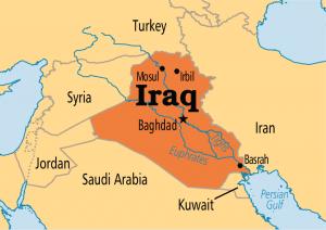
Image of Iraq:
Check out some more famous and interesting places on our planet:
- Sri Lanka
- Macao
- Ukraine
- Guinea-Bissau
- New Caledonia
- Guinea
- Ghana
- Georgia
- Gabon
- Ethiopia
- Djibouti
- Côte d'Ivoire
- Cuba
- Colombia
- Aruba
- Chad
- Cameroon
- Botswana
- Bosnia and Herzegovina
- Benin
This online map of Iraq is provided by OpenStreetMap.
Please add a bookmark and share the page with your friends!