The exact coordinates of Gateway Alaska for your GPS track:
Latitude 61.56572 North, Longitude 149.253769 West.
Please share the link with friends and neighbors:
Share on Facebook
Share on WhatsApp
Share on Telegram
Share on Facebook
Share on WhatsApp
Share on Telegram
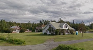
An image of Gateway
More city maps of Alaska:
- Map of College
College, Alaska is a nice CDP found in Fairbanks North Star Borough. It's commonly associated with... - Map of Sitka
Sitka, Alaska is a city and a borough located on Baranof Island in the Alexander Archipelago of th... - Map of Kodiak
Kodiak is a city located on Kodiak Island, Alaska. It is the largest community on Kodiak Island an...
Full list of Alaska maps
This online map of Gateway, Alaska is provided by Bing Maps. Please add a bookmark and share the page with your friends!