Hawaii County on the map of Hawaii 2026. Cities, roads, borders and directions in Hawaii County of Hawaii.
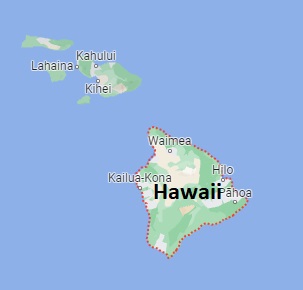
USA / Hawaii / Hawaii CountyHawaii County is located on the Hawaii Island, the largest on the archipelago of Hawaii. This famous county is named after Hawailoa, a legendary Polynesian navigator. The county seat of Hawaii County is Hilo. The county's area is about 4028 square miles, and today Hawaii County is home to 203 thousand residents. Hawaii County dates its history back to 1905. This map shows the borders of Hawaii County as well as neighboring counties, including major highways and natural objecsts as of 2026. Zoom in or out of the map using the plus/minus panel. Move the center of this map by dragging it. Also check out the satellite map of Hawaii County.
The borders of Hawaii County over the map of Hawaii
Explore some more counties of Hawaii:
Full list of Hawaii maps
This online map of Hawaii County, Hawaii is provided by Bing Maps. Please add a bookmark and share the page with your friends!
© 2026 City maps and famous places