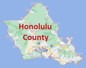
Honolulu County is the territory occupying 100% of Oahu island in Hawaii. The total population of Honolulu County is about a million people. This map shows the borders of Honolulu County as well as neighboring counties,
including major highways and natural objecsts as of 2024.
Zoom in or out of the map using the plus/minus panel. Move the center of this map by dragging it.
Also check out the satellite map of Honolulu County.
Please share the map of Honolulu County with your friends:
The borders of Honolulu County over the map of Hawaii
Explore some more counties of Hawaii:
This online map of Honolulu County, Hawaii is provided by Bing Maps.
Please add a bookmark and share the page with your friends!