Woodford County on the map of Kentucky 2026. Cities, roads, borders and directions in Woodford County of Kentucky.
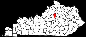
USA / Kentucky / Woodford CountyWoodford County is found in the central part of Kentucky. This amazing county is named after William Woodford (1734-80), Revolutionary War general. The overall population of Woodford County reaches 27 thousand people. The county, organized in 1788, covers an area of 191 square miles. The county seat of Woodford County is Versailles. This map shows the borders of Woodford County as well as neighboring counties, including major highways and natural objecsts as of 2026. Zoom in or out of the map using the plus/minus panel. Move the center of this map by dragging it. Also check out the satellite map of Woodford County.
The borders of Woodford County over the map of Kentucky
Explore some more counties of Kentucky:
- Wolfe County
- Whitley County
- Webster County
- Wayne County
- Washington County
- Warren County
- Union County
- Trimble County
- Trigg County
- Todd County
- Taylor County
- Spencer County
- Simpson County
- Shelby County
- Scott County
- Russell County
- Rowan County
- Rockcastle County
- Robertson County
- Pulaski County
Full list of Kentucky maps
This online map of Woodford County, Kentucky is provided by Bing Maps. Please add a bookmark and share the page with your friends!
© 2026 City maps and famous places