Columbiana County on the map of Ohio 2026. Cities, roads, borders and directions in Columbiana County of Ohio.
USA / Ohio / Columbiana CountyColumbiana County is placed on the eastern border of Ohio. This glorious county is named after Christopher Columbus, European explorer of the Americas. The total population of Columbiana County exceeds 101 thousand people. The county, founded on May 1, 1803 as a part of Jefferson and Washington Counties, covers an area of 532.46 square miles. The county seat of Columbiana County is Lisbon. This map shows the borders of Columbiana County as well as neighboring counties, including major highways and natural objecsts as of 2026. Zoom in or out of the map using the plus/minus panel. Move the center of this map by dragging it. Also check out the satellite map of Columbiana County.
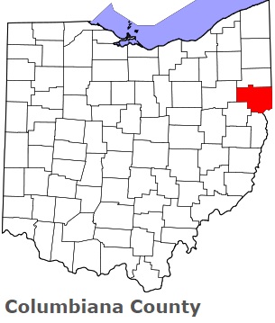
The borders of Columbiana County over the map of Ohio
Explore some more counties of Ohio:
- Wyandot County
- Wood County
- Williams County
- Wayne County
- Washington County
- Warren County
- Vinton County
- Van Wert County
- Ross County
- Union County
- Richland County
- Tuscarawas County
- Putnam County
- Trumbull County
- Preble County
- Summit County
- Portage County
- Stark County
- Pike County
- Shelby County
Full list of Ohio maps
This online map of Columbiana County, Ohio is provided by Bing Maps. Please add a bookmark and share the page with your friends!
© 2026 City maps and famous places