Pike County on the map of Ohio 2026. Cities, roads, borders and directions in Pike County of Ohio.
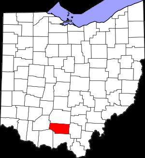
USA / Ohio / Pike CountyPike County is situated in the southern section of Ohio. This well known county was named after General Zebulon M. Pike (1779-1813), a War of 1812 officer and discoverer of Pikes Peak in Colorado. The area of Pike County is about 441.49 square miles. The county, established on Feb 1, 1815 from Ross, Scioto, and Adams Counties, and it is populated today by 27 thousand residents. Waverly is the county seat of Pike County. This map shows the borders of Pike County as well as neighboring counties, including major highways and natural objecsts as of 2026. Zoom in or out of the map using the plus/minus panel. Move the center of this map by dragging it. Also check out the satellite map of Pike County.
The borders of Pike County over the map of Ohio
Explore some more counties of Ohio:
- Wyandot County
- Wood County
- Williams County
- Wayne County
- Washington County
- Warren County
- Vinton County
- Van Wert County
- Ross County
- Union County
- Richland County
- Tuscarawas County
- Putnam County
- Trumbull County
- Preble County
- Summit County
- Portage County
- Stark County
- Shelby County
- Pickaway County
Full list of Ohio maps
This online map of Pike County, Ohio is provided by Bing Maps. Please add a bookmark and share the page with your friends!
© 2026 City maps and famous places