Pickaway County on the map of Ohio 2026. Cities, roads, borders and directions in Pickaway County of Ohio.
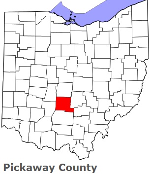
USA / Ohio / Pickaway CountyPickaway County is placed in the central region of Ohio. This famous county was named after A misspelling of the Piqua tribe, a branch of the Shawnee. The total population of Pickaway County exceeds 59 thousand people. The county, organized on Mar 1, 1810 as a part of Ross, Fairfield, and Franklin Counties, covers an area of 501.91 square miles. The county seat of Pickaway County is Circleville. This map shows the borders of Pickaway County as well as neighboring counties, including major highways and natural objecsts as of 2026. Zoom in or out of the map using the plus/minus panel. Move the center of this map by dragging it. Also check out the satellite map of Pickaway County.
The borders of Pickaway County over the map of Ohio
Explore some more counties of Ohio:
- Wyandot County
- Wood County
- Williams County
- Wayne County
- Washington County
- Warren County
- Vinton County
- Van Wert County
- Ross County
- Union County
- Richland County
- Tuscarawas County
- Putnam County
- Trumbull County
- Preble County
- Summit County
- Portage County
- Stark County
- Pike County
- Shelby County
Full list of Ohio maps
This online map of Pickaway County, Ohio is provided by Bing Maps. Please add a bookmark and share the page with your friends!
© 2026 City maps and famous places