Warren County on the map of Ohio 2025. Cities, roads, borders and directions in Warren County of Ohio.
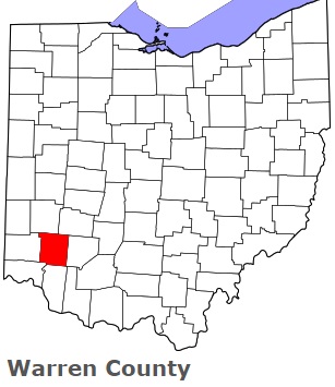
USA / Ohio / Warren CountyWarren County is located in the southwestern part of Ohio. This remarkable county was named after General Joseph Warren (1741-1775), a Revolutionary War officer. The county seat of Warren County is Lebanon. The county's area exceeds 399.63 square miles. Established on May 1, 1803 from Hamilton County, today Warren County counts over 247 thousand inhabitants. This map shows the borders of Warren County as well as neighboring counties, including major highways and natural objecsts as of 2025. Zoom in or out of the map using the plus/minus panel. Move the center of this map by dragging it. Also check out the satellite map of Warren County.
The borders of Warren County over the map of Ohio
Explore some more counties of Ohio:
- Wyandot County
- Wood County
- Williams County
- Wayne County
- Washington County
- Vinton County
- Van Wert County
- Ross County
- Union County
- Richland County
- Tuscarawas County
- Putnam County
- Trumbull County
- Preble County
- Summit County
- Portage County
- Stark County
- Pike County
- Shelby County
- Pickaway County
Full list of Ohio maps
This online map of Warren County, Ohio is provided by Bing Maps. Please add a bookmark and share the page with your friends!
© 2025 City maps and famous places