Summit County on the map of Ohio 2026. Cities, roads, borders and directions in Summit County of Ohio.
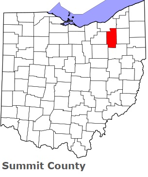
USA / Ohio / Summit CountySummit County is situated in the northern region of Ohio. This well known county was named after its location at the highest elevation along the Ohio and Erie Canal. The area of Summit County is about 419.38 square miles. The county, established on Mar 3, 1840 from Medina, Portage, and Stark Counties, and it is populated today by 538 thousand residents. Akron is the county seat of Summit County. This map shows the borders of Summit County as well as neighboring counties, including major highways and natural objecsts as of 2026. Zoom in or out of the map using the plus/minus panel. Move the center of this map by dragging it. Also check out the satellite map of Summit County.
The borders of Summit County over the map of Ohio
Explore some more counties of Ohio:
- Wyandot County
- Wood County
- Williams County
- Wayne County
- Washington County
- Warren County
- Vinton County
- Van Wert County
- Ross County
- Union County
- Richland County
- Tuscarawas County
- Putnam County
- Trumbull County
- Preble County
- Portage County
- Stark County
- Pike County
- Shelby County
- Pickaway County
Full list of Ohio maps
This online map of Summit County, Ohio is provided by Bing Maps. Please add a bookmark and share the page with your friends!
© 2026 City maps and famous places