Please share the link with friends and neighbors:
Share on Facebook
Share on WhatsApp
Share on Telegram
Share on Facebook
Share on WhatsApp
Share on Telegram
Mont Blanc is listed in:
Cool facts and FAQ about Mont Blanc:
What is Mont Blanc?Why is Mont Blanc famous?
Can you climb Mont Blanc?
What is the Mont Blanc Tunnel?
Is Mont Blanc dangerous?
What wildlife and nature can be found around Mont Blanc?
Cool facts about Mont Blanc
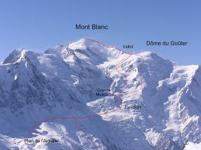
Image of Mont Blanc:
Check out some more famous and interesting places on our planet:
- Stromboli volcano
- Genting Snow Park
- Cumbre Vieja
- Mount Lewotolo
- Nevado Mismi
- Mount Rainier
- Mount Elbrus
- Mount Carmel
- Matterhorn
- Mount Everest
- Devils Tower
- Ben Nevis mountain
- Mount Etna
- Mount Fuji
This online map of Mont Blanc is provided by OpenStreetMap.
Please add a bookmark and share the page with your friends!