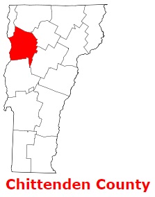
Chittenden County is located in the northwestern section of Vermont. The shire town of Chittenden County is Burlington. The overall area of the county is about 539 square miles. Founded in 1787 as part of Addison County, today Chittenden County counts over 169 thousand inhabitants. The county is named after Thomas Chittenden (1730-1797), first governor of Vermont (1791-1797). This map shows the borders of Chittenden County as well as neighboring counties,
including major highways and natural objecsts as of 2024.
Zoom in or out of the map using the plus/minus panel. Move the center of this map by dragging it.
Also check out the satellite map of Chittenden County.
Please share the map of Chittenden County with your friends:
The borders of Chittenden County over the map of Vermont
Explore some more counties of Vermont:
This online map of Chittenden County, Vermont is provided by Bing Maps.
Please add a bookmark and share the page with your friends!