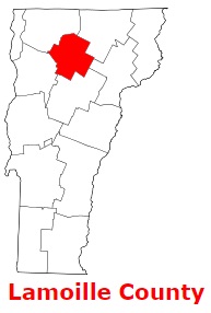
Lamoille County is found in the northern area of Vermont. The population of Lamoille County exceeds 26 thousand people. The county, founded back in 1835 as parts of Chittenden, Franklin, Orleans and Washington Counties, spans a total area of 461 square miles. The shire town of Lamoille County is Hyde Park (town). The county is named after La Mouette (meaning the seagull), named by French explorer Samuel de Champlain. This map shows the borders of Lamoille County as well as neighboring counties,
including major highways and natural objecsts as of 2024.
Zoom in or out of the map using the plus/minus panel. Move the center of this map by dragging it.
Also check out the satellite map of Lamoille County.
Please share the map of Lamoille County with your friends:
The borders of Lamoille County over the map of Vermont
Explore some more counties of Vermont:
This online map of Lamoille County, Vermont is provided by Bing Maps.
Please add a bookmark and share the page with your friends!