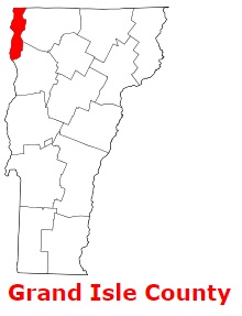
Grand Isle County is located in the northwestern corner of Vermont. The shire town of Grand Isle County is North Hero. The overall area of the county is about 83 square miles. Set up in 1802 as part of Chittenden County and Franklin County, today Grand Isle County counts over 7 thousand inhabitants. The county is named after Largest island in Lake Champlain. This map shows the borders of Grand Isle County as well as neighboring counties,
including major highways and natural objecsts as of 2024.
Zoom in or out of the map using the plus/minus panel. Move the center of this map by dragging it.
Also check out the satellite map of Grand Isle County.
Please share the map of Grand Isle County with your friends:
The borders of Grand Isle County over the map of Vermont
Explore some more counties of Vermont:
This online map of Grand Isle County, Vermont is provided by Bing Maps.
Please add a bookmark and share the page with your friends!