Belknap County on the map of New Hampshire 2026. Cities, roads, borders and directions in Belknap County of New Hampshire.
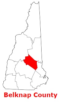
USA / New Hampshire / Belknap CountyBelknap County is located in the central inland part of New Hampshire. The county seat of Belknap County is Laconia. The overall area of the county is about 401 square miles. Established back in 1840, today Belknap County counts over 64 thousand inhabitants. The county is named after Jeremy Belknap (1744-1798), early New Hampshire historian. This map shows the borders of Belknap County as well as neighboring counties, including major highways and natural objecsts as of 2026. Zoom in or out of the map using the plus/minus panel. Move the center of this map by dragging it. Also check out the satellite map of Belknap County.
The borders of Belknap County over the map of New Hampshire
Explore some more counties of New Hampshire:
- Sullivan County
- Strafford County
- Rockingham County
- Merrimack County
- Hillsborough County
- Grafton County
- Coos County
- Cheshire County
- Carroll County
Full list of New Hampshire maps
This online map of Belknap County, New Hampshire is provided by Bing Maps. Please add a bookmark and share the page with your friends!
© 2026 City maps and famous places