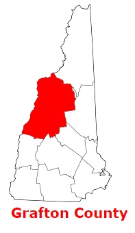
Grafton County is located in the western section of central New Hampshire. The population of Grafton County exceeds 91 thousand people. The county, established back in 1769, spans a total area of 1,714 square miles. The county seat of Grafton County is North Haverhill. The county is named after Augustus Henry Fitzroy, 3rd Duke of Grafton, a Prime Minister of Great Britain. This map shows the borders of Grafton County as well as neighboring counties,
including major highways and natural objecsts as of 2024.
Zoom in or out of the map using the plus/minus panel. Move the center of this map by dragging it.
Also check out the satellite map of Grafton County.
Please share the map of Grafton County with your friends:
The borders of Grafton County over the map of New Hampshire
Explore some more counties of New Hampshire:
This online map of Grafton County, New Hampshire is provided by Bing Maps.
Please add a bookmark and share the page with your friends!