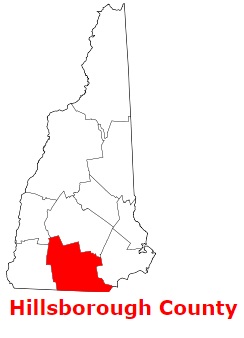
Hillsborough County is found in the southern portion of New Hampshire. The area of Hillsborough County is about 876 square miles. The county was formed in 1769 and it is populated today by 423 thousand residents. Manchester and Nashua is the county seat of Hillsborough County. The county is named after Wills Hill, 1st Marquess of Downshire (1718-1793), known as the Earl of Hillsborough. This map shows the borders of Hillsborough County as well as neighboring counties,
including major highways and natural objecsts as of 2024.
Zoom in or out of the map using the plus/minus panel. Move the center of this map by dragging it.
Also check out the satellite map of Hillsborough County.
Please share the map of Hillsborough County with your friends:
The borders of Hillsborough County over the map of New Hampshire
Explore some more counties of New Hampshire:
This online map of Hillsborough County, New Hampshire is provided by Bing Maps.
Please add a bookmark and share the page with your friends!