Carroll County on the map of New Hampshire 2025. Cities, roads, borders and directions in Carroll County of New Hampshire.
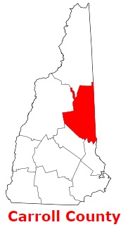
USA / New Hampshire / Carroll CountyCarroll County is situated in the eastern region of New Hampshire. The population of Carroll County exceeds 50 thousand people. The county, formed back in 1840, spans a total area of 934 square miles. The county seat of Carroll County is Ossipee. The county is named after Charles Carroll of Carrollton (1737-1832), one of those who signed the United States Declaration of Independence. This map shows the borders of Carroll County as well as neighboring counties, including major highways and natural objecsts as of 2025. Zoom in or out of the map using the plus/minus panel. Move the center of this map by dragging it. Also check out the satellite map of Carroll County.
The borders of Carroll County over the map of New Hampshire
Explore some more counties of New Hampshire:
- Sullivan County
- Strafford County
- Rockingham County
- Merrimack County
- Hillsborough County
- Grafton County
- Coos County
- Cheshire County
- Belknap County
Full list of New Hampshire maps
This online map of Carroll County, New Hampshire is provided by Bing Maps. Please add a bookmark and share the page with your friends!
© 2025 City maps and famous places