Rockingham County on the map of New Hampshire 2026. Cities, roads, borders and directions in Rockingham County of New Hampshire.
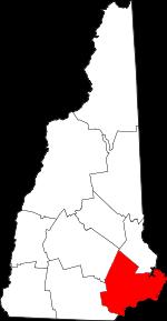
USA / New Hampshire / Rockingham CountyRockingham County is a coastal county located in the southeastern corner of New Hampshire. The population of Rockingham County exceeds 314 thousand people. The county, founded back in 1769, spans a total area of 695 square miles. The county seat of Rockingham County is Brentwood. The county is named after Charles Watson-Wentworth, 2nd Marquess of Rockingham (1730-1782), a Prime Minister of Great Britain. This map shows the borders of Rockingham County as well as neighboring counties, including major highways and natural objecsts as of 2026. Zoom in or out of the map using the plus/minus panel. Move the center of this map by dragging it. Also check out the satellite map of Rockingham County.
The borders of Rockingham County over the map of New Hampshire
Explore some more counties of New Hampshire:
- Sullivan County
- Strafford County
- Merrimack County
- Hillsborough County
- Grafton County
- Coos County
- Cheshire County
- Carroll County
- Belknap County
Full list of New Hampshire maps
This online map of Rockingham County, New Hampshire is provided by Bing Maps. Please add a bookmark and share the page with your friends!
© 2026 City maps and famous places