Strafford County on the map of New Hampshire 2026. Cities, roads, borders and directions in Strafford County of New Hampshire.
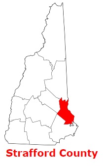
USA / New Hampshire / Strafford CountyStrafford County is situated in the eastern section of New Hampshire. The area of Strafford County is about 369 square miles. The county was established in 1769 and it is populated today by 131 thousand residents. Dover is the county seat of Strafford County. The county is named after William Wentworth, 2nd Earl of Strafford (1626-1695), an English noble who owned colonial lands. This map shows the borders of Strafford County as well as neighboring counties, including major highways and natural objecsts as of 2026. Zoom in or out of the map using the plus/minus panel. Move the center of this map by dragging it. Also check out the satellite map of Strafford County.
The borders of Strafford County over the map of New Hampshire
Explore some more counties of New Hampshire:
- Sullivan County
- Rockingham County
- Merrimack County
- Hillsborough County
- Grafton County
- Coos County
- Cheshire County
- Carroll County
- Belknap County
Full list of New Hampshire maps
This online map of Strafford County, New Hampshire is provided by Bing Maps. Please add a bookmark and share the page with your friends!
© 2026 City maps and famous places