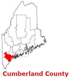
Cumberland County is a coastal county in the southern section of Maine. The area of Cumberland County is about 1,217 square miles. The county was set up in 1761 as Cumberland County, Massachusetts from part of York County, and it is populated today by 305 thousand residents. Portland is the county seat of Cumberland County. The county is named after Prince William Augustus, Duke of Cumberland, son of George II of Great Britain. This map shows the borders of Cumberland County as well as neighboring counties,
including major highways and natural objecsts as of 2024.
Zoom in or out of the map using the plus/minus panel. Move the center of this map by dragging it.
Also check out the satellite map of Cumberland County.
Please share the map of Cumberland County with your friends:
The borders of Cumberland County over the map of Maine
Explore some more counties of Maine:
This online map of Cumberland County, Maine is provided by Bing Maps.
Please add a bookmark and share the page with your friends!