Kennebec County on the map of Maine 2025. Cities, roads, borders and directions in Kennebec County of Maine.
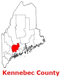
USA / Maine / Kennebec CountyKennebec County is an inland county located in the southern section of Maine. The area of Kennebec County is about 951 square miles. The county was formed in 1799 as Kennebec County, Massachusetts from part of Lincoln County, and it is populated today by 124 thousand residents. Augusta is the county seat of Kennebec County. The county is named after the Kennebec River in Maine. This map shows the borders of Kennebec County as well as neighboring counties, including major highways and natural objecsts as of 2025. Zoom in or out of the map using the plus/minus panel. Move the center of this map by dragging it. Also check out the satellite map of Kennebec County.
The borders of Kennebec County over the map of Maine
Explore some more counties of Maine:
- York County
- Washington County
- Waldo County
- Somerset County
- Sagadahoc County
- Piscataquis County
- Penobscot County
- Oxford County
- Lincoln County
- Knox County
- Hancock County
- Franklin County
- Cumberland County
- Aroostook County
- Androscoggin County
Full list of Maine maps
This online map of Kennebec County, Maine is provided by Bing Maps. Please add a bookmark and share the page with your friends!
© 2025 City maps and famous places