Ravalli County on the map of Montana 2026. Cities, roads, borders and directions in Ravalli County of Montana.
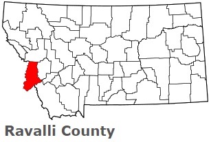
USA / Montana / Ravalli CountyRavalli County is located on the western border of Montana. This cool county is named after Anthony Ravalli (1812-1884), a Jesuit missionary who came to the area in 1845. The county seat of Ravalli County is Hamilton. The county's area is about 2394 square miles. Established on February 16, 1893, today Ravalli County is home to 46 thousand residents. This map shows the borders of Ravalli County as well as neighboring counties, including major highways and natural objecsts as of 2026. Zoom in or out of the map using the plus/minus panel. Move the center of this map by dragging it. Also check out the satellite map of Ravalli County.
The borders of Ravalli County over the map of Montana
Explore some more counties of Montana:
- Yellowstone County
- Wibaux County
- Wheatland County
- Valley County
- Treasure County
- Toole County
- Teton County
- Sweet Grass County
- Stillwater County
- Silver Bow County
- Sheridan County
- Sanders County
- Rosebud County
- Roosevelt County
- Richland County
- Prairie County
- Powell County
- Powder River County
- Pondera County
- Phillips County
Full list of Montana maps
This online map of Ravalli County, Montana is provided by Bing Maps. Please add a bookmark and share the page with your friends!
© 2026 City maps and famous places